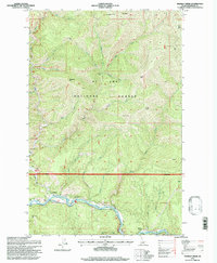
1995 Map of Marble Creek
USGS Topo · Published 1997About this map
The St Joe River winds through the southern portion of this landscape, flanked by the timbered slopes of the St Joe National Forest. Near the bend in the river, the small settlement of Herrick sits at the base of Maternity Hill, serving as a key point of reference in this drainage-rich terrain. The map captures a moment when the legacy of local industry is visible through the Old RR Grade, which follows the northern bank of the river, tracing the path once used to transport timber through these steep valleys.
Find a feature on this map
32 named features on this map. Tap any name to fly to it.
Don’t see what you’re looking for? This feature index may not catch every label — zoom into the map to look around manually.
Map Details
Editions of this 1995 Marble Creek Map
This is the sole edition of this map. No revisions or reprints were ever made.
Other maps of this area

1914 · Avery
USGS Topo · 1:125,000

1917 · Avery
USGS Topo · 1:125,000

1955 · Spokane
USGS Topo · 1:250,000

1956 · Wallace
USGS Topo · 1:250,000

1957 · Wallace
USGS Topo · 1:62,500

1957 · Calder
USGS Topo · 1:62,500

1958 · Spokane
USGS Topo · 1:250,000

1960 · Wallace
USGS Topo · 1:250,000

1969 · Marble Mountain
USGS Topo · 1:24,000
1969 · Hoyt Mountain
USGS Topo · 1:24,000