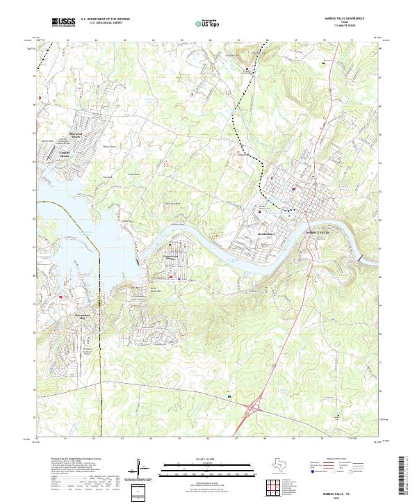
2022 Map of Marble Falls
USGS Topo · Published 2022About this map
The Colorado River carves a dramatic course through this Central Texas landscape, defining the boundaries and development of modern lakeside communities. Marble Falls serves as the eastern anchor, where the river transitions into Lake Marble Falls, while to the west, the expansive waters of Lake Lyndon B Johnson are bordered by Horseshoe Bay and Granite Shoals. The presence of Granite Mtn and various named outcrops like Goose Rock and School Rock points to the area's famous pink granite geology, which has shaped local industry and terrain.
Find a feature on this map
233 named features on this map. Tap any name to fly to it.
Don’t see what you’re looking for? This feature index may not catch every label — zoom into the map to look around manually.
Map Details
Editions of this 2022 Marble Falls Map
This is the sole edition of this map. No revisions or reprints were ever made.
Other maps of this area

1887 · Blanco
USGS Topo · 1:125,000

1887 · Burnet
USGS Topo · 1:125,000

1893 · Burnet
USGS Topo · 1:125,000

1894 · Blanco
USGS Topo · 1:125,000

1903 · Burnet
USGS Topo · 1:125,000

1909 · Burnet
USGS Topo · 1:125,000

1925 · Burnet 3-b
USGS Topo · 1:48,000

1925 · Burnet 3-d
USGS Topo · 1:48,000

1929 · Marble Falls
USGS Topo · 1:62,500

1931 · Marble Falls
USGS Topo · 1:48,000