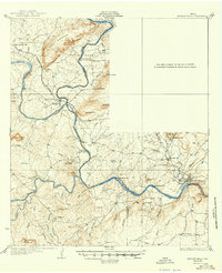
1932 Map of Marble Falls
USGS Topo · Published 1949About this map
Colorado River and Llano River come together in a landscape of dramatic elevation and early industrial development in this early twentieth-century survey. The terrain is defined by the massive granite outcrops and deep river valleys that shaped the region's economy, as evidenced by the Southern Pacific rail line and Granite Mtn Sta serving the famed quarries. Rural life is well-documented through a network of small schoolhouses such as Hoover Sch, La Vista Sch, and Sandy Mtn Sch, which served the scattered residents of Hoover Valley and Kings Land Valley.
Find a feature on this map
64 named features on this map. Tap any name to fly to it.
Don’t see what you’re looking for? This feature index may not catch every label — zoom into the map to look around manually.
Map Details
Editions of this 1932 Marble Falls Map
2 editions found

Other maps of this area

1887 · Llano
USGS Topo · 1:125,000

1887 · Blanco
USGS Topo · 1:125,000

1887 · Burnet
USGS Topo · 1:125,000

1893 · Burnet
USGS Topo · 1:125,000

1894 · Fredericksburg
USGS Topo · 1:125,000

1894 · Blanco
USGS Topo · 1:125,000

1894 · Llano
USGS Topo · 1:125,000

1903 · Burnet
USGS Topo · 1:125,000

1904 · Llano
USGS Topo · 1:125,000

1909 · Llano
USGS Topo · 1:125,000