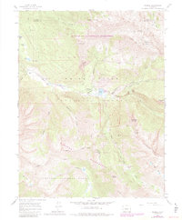
1960 Map of Marble
USGS Topo · Published 1984About this map
Marble serves as the focal point for this mountain landscape, positioned along the banks of the Crystal River. The map details the extraction history of the region, notably featuring the Yule Quarry and Strauss Quarry south of the townsite, along with the Genter Mine and Skyline Mine tucked into the surrounding slopes. Transportation and recreation patterns are evident through the presence of a Landing Strip and the Colorado Outward Bound School, reflecting the area's development into a base for wilderness exploration within the Maroon Bells-Snowmass Wilderness and Raggeds Wilderness. Genealogists may find interest in the Marble Cemetery, while the wider landscape is punctuated by landmark peaks such as Mount Justice and Treasure Mountain. The presence of several ranches, including Bair Ranch and Snowshoe Ranch, indicates the localized agricultural footprint maintained amidst the vast stretches of the White River National Forest.
Find a feature on this map
57 named features on this map. Tap any name to fly to it.
Don’t see what you’re looking for? This feature index may not catch every label — zoom into the map to look around manually.
Map Details
Editions of this 1960 Marble Map
5 editions found

Other maps of this area

1888 · Anthracite
USGS Topo · 1:62,500

1889 · Anthracite
USGS Topo · 1:62,500

1893 · Anthracite
USGS Topo · 1:62,500

1894 · Anthracite
USGS Topo · 1:62,500

1938 · Mt. Gunnison
USGS Topo · 1:48,000

1945 · Mount Gunnison
USGS Topo · 1:62,500

1956 · Montrose
USGS Topo · 1:250,000

1957 · Leadville
USGS Topo · 1:250,000

1959 · Leadville
USGS Topo · 1:250,000

1959 · Montrose
USGS Topo · 1:250,000