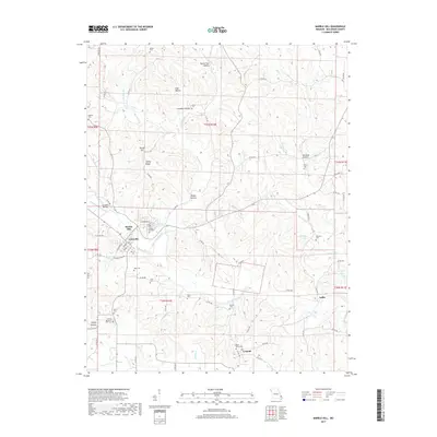
2017 Map of Marble Hill
USGS Topo · Published 2017About this map
Marble Hill and Lutesville sit at the geographic heart of this Bollinger County study, centered where Hurricane Cr and Crooked Cr converge. The landscape is defined by a dense network of winding county roads that connect isolated settlements and family burial grounds. Notable genealogy resources include the Saint Johns Cem near Leopold and the County Memorial Park Cem further south. The topography is marked by named drainages and depressions such as Happy Hollow and Board Tree Hollow, illustrating a deeply dissected terrain typical of the region. Aviation history is noted by the presence of the Ira Biffle Airfield west of the primary town centers. Toward the eastern boundary, the map tracks the smaller community of Laflin and recreational or water features like Bollinger Lake and Lukefahr Lake, showing the transition from the central river valleys into the rising ridges of Turkey Hill.
Find a feature on this map
87 named features on this map. Tap any name to fly to it.
Don’t see what you’re looking for? This feature index may not catch every label — zoom into the map to look around manually.
Map Details
Editions of this 2017 Marble Hill Map
This is the sole edition of this map. No revisions or reprints were ever made.
Other maps of this area

1933 · Marble Hill
USGS Topo · 1:62,500

1933 · Marquand
USGS Topo · 1:62,500

1934 · Advance
USGS Topo · 1:62,500

1935 · Zalma
USGS Topo · 1:62,500

1937 · Marble Hill
USGS Topo · 1:62,500

1938 · Marquand
USGS Topo · 1:62,500

1939 · Advance
USGS Topo · 1:62,500

1939 · Zalma
USGS Topo · 1:62,500

1949 · Paducah
USGS Topo · 1:250,000

1949 · Rolla
USGS Topo · 1:250,000