1980 Map of Marble Mountain
USGS Topo · Published 1980About this map
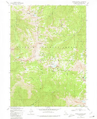
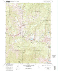
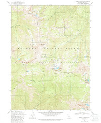
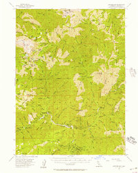
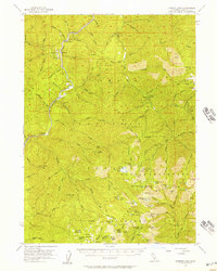
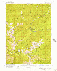
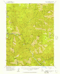
Klamath National Forest dominates this 1980 survey, specifically highlighting the high-elevation terrain of the Marble Mountain Wilderness. The map reveals a landscape defined by dramatic geological features like Kings Castle and Black Marble Mountain, punctuated by a series of high alpine basins. Long-distance recreation is represented by the Pacific Crest National Scenic Trail, which winds through the central peaks. Tracing the drainages of Kelsey Creek and Wooley Creek, the map shows a network of remote campsites and isolated water bodies, such as Man Eaten Lake and Paradise Lake. A Forest Service Station in Marble Valley serves as a lone administrative outpost in a region largely devoid of permanent settlements or improved roads, emphasizing the area's role as a protected backcountry resource in the late twentieth century.
Find a feature on this map
48 named features on this map. Tap any name to fly to it.
Don’t see what you’re looking for? This feature index may not catch every label — zoom into the map to look around manually.
Map Details
Editions of this 1980 Marble Mountain Map
3 editions found
Other maps of this area

1914 · Seiad
USGS Topo · 1:125,000

1922 · Seiad
USGS Topo · 1:125,000

1948 · Weed
USGS Topo · 1:250,000

1950 · Weed
USGS Topo · 1:250,000
1955 · Sawyers Bar
USGS Topo · 1:62,500
1955 · Ukonom Lake
USGS Topo · 1:62,500
1955 · Scott Bar
USGS Topo · 1:62,500
1955 · Forks of Salmon
USGS Topo · 1:62,500

1958 · Weed
USGS Topo · 1:250,000

1963 · Weed
USGS Topo · 1:250,000