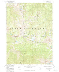
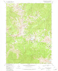
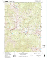
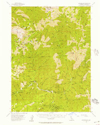
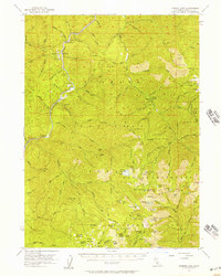
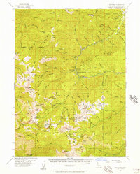
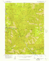
1980 Map of Marble Mountain
USGS Topo · Published 1988About this map
Marble Mountain and the surrounding high peaks of the Marble Mountain Wilderness define this high-altitude terrain within the Klamath National Forest. The 1980 survey captures the corridor of the Pacific Crest National Scenic Trail as it winds past geological landmarks like Kings Castle and Black Marble Mountain. This area is characterized by its glacial hydrology, featuring a high density of alpine water bodies including Paradise Lake, Rainy Lake, and the cluster of Upper Sky High Lake and Lower Sky High Lake. Human presence is marked by a series of remote outposts and seasonal camps, such as the Forest Service Station in Marble Valley and the curiously named Whisky Camp. Deep drainage basins for Elk Creek and Wooley Creek illustrate the sharp vertical relief typical of the Siskiyou region during this era of conservation and forest management.
Find a feature on this map
48 named features on this map. Tap any name to fly to it.
Don’t see what you’re looking for? This feature index may not catch every label — zoom into the map to look around manually.
Map Details
Editions of this 1980 Marble Mountain Map
3 editions found
Other maps of this area

1914 · Seiad
USGS Topo · 1:125,000

1922 · Seiad
USGS Topo · 1:125,000

1948 · Weed
USGS Topo · 1:250,000

1950 · Weed
USGS Topo · 1:250,000
1955 · Sawyers Bar
USGS Topo · 1:62,500
1955 · Ukonom Lake
USGS Topo · 1:62,500
1955 · Scott Bar
USGS Topo · 1:62,500
1955 · Forks of Salmon
USGS Topo · 1:62,500

1958 · Weed
USGS Topo · 1:250,000

1963 · Weed
USGS Topo · 1:250,000