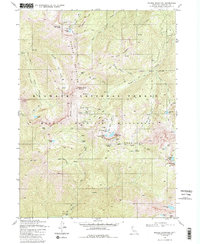
1980 Map of Marble Mountain
USGS Topo · Published 1988About this map
The high-elevation terrain of the Marble Mountains dominates this portion of the Klamath National Forest, defined by a network of seasonal camps and alpine water bodies. The rugged landscape includes numerous small lakes such as Frying Pan Lake, Upper Sky High Lake, and the curiously named Man Eaten Lake. Established outposts like Whisky Camp, Big Rock Camp, and Ananias Camp reflect the area’s history of backcountry exploration and Forest Service management, anchored by a Forest Service Station in Marble Valley.
Find a feature on this map
47 named features on this map. Tap any name to fly to it.
Don’t see what you’re looking for? This feature index may not catch every label — zoom into the map to look around manually.
Map Details
Editions of this 1980 Marble Mountain Map
3 editions found
Other maps of this area

1914 · Seiad
USGS Topo · 1:125,000

1922 · Seiad
USGS Topo · 1:125,000

1948 · Weed
USGS Topo · 1:250,000

1950 · Weed
USGS Topo · 1:250,000

1955 · Sawyers Bar
USGS Topo · 1:62,500

1955 · Ukonom Lake
USGS Topo · 1:62,500

1955 · Scott Bar
USGS Topo · 1:62,500

1955 · Forks of Salmon
USGS Topo · 1:62,500

1958 · Weed
USGS Topo · 1:250,000

1963 · Weed
USGS Topo · 1:250,000