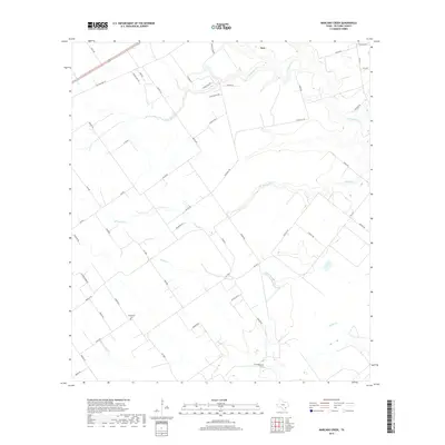
2019 Map of Marcado Creek
USGS Topo · Published 2019About this map
The Shillerville Cem serves as a quiet landmark in the southern reaches of this Victoria County landscape, where the rural road network intersects with several winding waterways. The drainage pattern is defined by the eastward flow of Marcado Cr, Agula Cr, and the Arroyo Palo Alto, which carve through the coastal plains. Near the northern boundary, the settlement of Inez sits just above the confluence area of Casa Blanca Cr and Garcitas Cr. This area is characterized by large agricultural tracts and a systematic grid of farm-to-market roads, including FM 1686 and FM 444 S, which connect family-named properties and local groves like Garcitas Grove. The map provides a detailed view of the modern land divisions and rural infrastructure that sustain this South Texas ranching and farming community.
Find a feature on this map
50 named features on this map. Tap any name to fly to it.
Don’t see what you’re looking for? This feature index may not catch every label — zoom into the map to look around manually.
Map Details
Editions of this 2019 Marcado Creek Map
This is the sole edition of this map. No revisions or reprints were ever made.
Other maps of this area

1951 · Bloomington
USGS Topo · 1:24,000

1951 · Inez NW
USGS Topo · 1:24,000

1951 · Inez
USGS Topo · 1:24,000

1952 · Edna
USGS Topo · 1:24,000

1952 · Kamey
USGS Topo · 1:24,000

1952 · La Salle
USGS Topo · 1:24,000

1952 · Marcado Creek
USGS Topo · 1:24,000

1952 · Placedo
USGS Topo · 1:24,000

1952 · Victoria East
USGS Topo · 1:24,000

1953 · Beeville
USGS Topo · 1:250,000