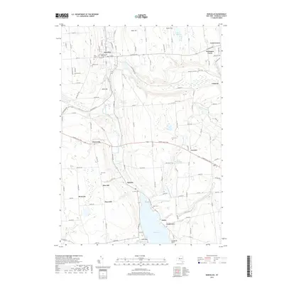
2019 Map of Marcellus
USGS Topo · Published 2019About this map
Ninemile Creek carves a deep valley through the center of this Onondaga County landscape, connecting the northern village of Marcellus to the head of Otisco Lake in the south. The terrain is defined by a series of prominent rises including Baker Hill, Bishop Hill, and Rose Hill, which dictated the layout of historical transport routes like the W Seneca Tpke and Cherry Valley Tpke.
Find a feature on this map
121 named features on this map. Tap any name to fly to it.
Don’t see what you’re looking for? This feature index may not catch every label — zoom into the map to look around manually.
Map Details
Editions of this 2019 Marcellus Map
This is the sole edition of this map. No revisions or reprints were ever made.
Other maps of this area

1895 · Syracuse
USGS Topo · 1:62,500

1898 · Syracuse
USGS Topo · 1:62,500

1899 · Skaneateles
USGS Topo · 1:62,500

1900 · Baldwinsville
USGS Topo · 1:62,500

1900 · Tully
USGS Topo · 1:62,500

1902 · Skaneateles
USGS Topo · 1:62,500

1939 · Syracuse West
USGS Topo · 1:24,000

1943 · South Onondaga
USGS Topo · 1:31,680

1943 · Jordan
USGS Topo · 1:31,680

1943 · Spafford
USGS Topo · 1:31,680