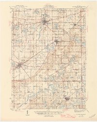
1946 Map of Marcellus
USGS Topo · Published 1946About this map
Paw Paw and Lawton anchor this detailed look at southwestern Michigan, where the village and township boundaries of Van Buren and Cass counties meet. The landscape is defined by its complex hydrology, featuring numerous lakes and managed drainage systems like Buckley Drain and Dowagiac Drain. The transportation network reveals the importance of rail corridors, with the New York Central, Pere Marquette, and Grand Trunk lines connecting rural settlements.
Find a feature on this map
106 named features on this map. Tap any name to fly to it.
Don’t see what you’re looking for? This feature index may not catch every label — zoom into the map to look around manually.
Map Details
Editions of this 1946 Marcellus Map
2 editions found

Other maps of this area

1914 · Three Rivers
USGS Topo · 1:62,500

1916 · Three Rivers
USGS Topo · 1:62,500

1916 · Kalamazoo
USGS Topo · 1:62,500

1918 · Kalamazoo
USGS Topo · 1:62,500

1922 · Schoolcraft
USGS Topo · 1:62,500

1927 · Hartford
USGS Topo · 1:62,500

1927 · Bangor
USGS Topo · 1:62,500

1931 · Bangor
USGS Topo · 1:62,500

1931 · Hartford
USGS Topo · 1:62,500

1943 · Three Rivers
USGS Topo · 1:62,500