
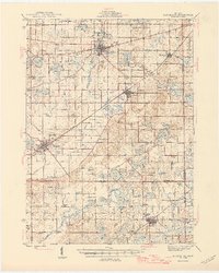
1946 Map of Marcellus
USGS Topo · Published 1946About this map
Paw Paw and Marcellus anchor this mid-century survey of the southwestern Michigan landscape, where the glacial influence is evident in a dense concentration of kettle lakes and drain systems. The region is heavily marked by rural infrastructure, featuring a significant network of one-room schoolhouses like Porter Center Sch and Huycktown Sch, alongside small country congregations at Wayne Chapel and Harmony Chapel. The transport corridor of the New York Central railroad bisects the terrain, connecting Decatur with the wider region while bypassing smaller settlements such as Nicholsville and Volinia. The intricate network of artificial channels, including Buckley Drain and Gates Drain, highlights a legacy of land management for agriculture in the marshy areas between Gravel Lake and Saddlebag Lake. For genealogists, the presence of numerous family-named burial grounds like Chamberlain Cem and Harwick Cem offers precise locations for ancestral research in Cass and Van Buren counties.
Find a feature on this map
103 named features on this map. Tap any name to fly to it.
Don’t see what you’re looking for? This feature index may not catch every label — zoom into the map to look around manually.
Map Details
Editions of this 1946 Marcellus Map
2 editions found
Other maps of this area

1914 · Three Rivers
USGS Topo · 1:62,500

1916 · Three Rivers
USGS Topo · 1:62,500

1916 · Kalamazoo
USGS Topo · 1:62,500

1918 · Kalamazoo
USGS Topo · 1:62,500

1922 · Schoolcraft
USGS Topo · 1:62,500

1927 · Hartford
USGS Topo · 1:62,500

1927 · Bangor
USGS Topo · 1:62,500

1931 · Bangor
USGS Topo · 1:62,500

1931 · Hartford
USGS Topo · 1:62,500

1943 · Three Rivers
USGS Topo · 1:62,500