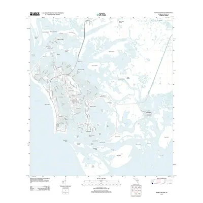
2012 Map of Marco Island
USGS Topo · Published 2012About this map
Marco Island is presented in the early 21st century as a complex landscape of master-planned coastal development set against a labyrinthine network of subtropical waterways. The dense street grids of the main settlement and the Isles of Capri contrast sharply with the neighboring Ten Thousand Islands wilderness to the east. This map provides a detailed look at the infrastructure that defines modern island life, including the Marco Island Airport and the bridge connections to the mainland.
Find a feature on this map
182 named features on this map. Tap any name to fly to it.
Don’t see what you’re looking for? This feature index may not catch every label — zoom into the map to look around manually.
Map Details
Editions of this 2012 Marco Island Map
This is the sole edition of this map. No revisions or reprints were ever made.
Other maps of this area

1956 · Miami
USGS Topo · 1:250,000

1956 · West Palm Beach
USGS Topo · 1:250,000

1957 · West Palm Beach
USGS Topo · 1:250,000

1958 · West Palm Beach
USGS Topo · 1:250,000

1958 · Miami
USGS Topo · 1:250,000

1958 · Belle Meade
USGS Topo · 1:24,000

1958 · Naples South
USGS Topo · 1:24,000

1958 · Belle Meade SE
USGS Topo · 1:24,000

1973 · Cape Romano
USGS Topo · 1:24,000

1973 · Marco Island
USGS Topo · 1:24,000