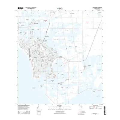
2015 Map of Marco Island
USGS Topo · Published 2015About this map
Marco Island is depicted here during a period of significant coastal density, where a grid of modern residential canals meets the complex mangrove estuaries of southwest Florida. The development spans from the northwestern shores at Smokehouse Bay down to the historic fishing vicinity of Caxambas and Caxambas Pass. This transition is most visible in the contrast between the dense street network of the central island and the surrounding keys, such as Isles of Capri and Goodland, which remain anchored to the intricate waterway system.
Find a feature on this map
202 named features on this map. Tap any name to fly to it.
Don’t see what you’re looking for? This feature index may not catch every label — zoom into the map to look around manually.
Map Details
Editions of this 2015 Marco Island Map
This is the sole edition of this map. No revisions or reprints were ever made.
Other maps of this area

1956 · Miami
USGS Topo · 1:250,000

1956 · West Palm Beach
USGS Topo · 1:250,000

1957 · West Palm Beach
USGS Topo · 1:250,000

1958 · West Palm Beach
USGS Topo · 1:250,000

1958 · Miami
USGS Topo · 1:250,000

1958 · Belle Meade
USGS Topo · 1:24,000

1958 · Naples South
USGS Topo · 1:24,000

1958 · Belle Meade SE
USGS Topo · 1:24,000

1973 · Cape Romano
USGS Topo · 1:24,000

1973 · Marco Island
USGS Topo · 1:24,000