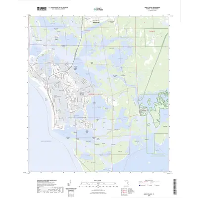
2024 Map of Marco Island
USGS Topo · Published 2024About this map
Marco Island and its surrounding archipelago are defined by a complex network of bays, keys, and tidal flats at the edge of the Ten Thousand Islands National Wildlife Refuge. The map reveals the intricate coastline of Collier County, where residential developments in Marco and the Isles of Capri sit adjacent to preserved mangrove systems and waterways like McIlvane Bay and Barfield Bay. A significant cultural and historical presence is noted through the Caxambas-Pioneer Cem and the San Marco Catholic Church Memorial Garden Cem, marking the enduring roots of these island communities.
Find a feature on this map
189 named features on this map. Tap any name to fly to it.
Don’t see what you’re looking for? This feature index may not catch every label — zoom into the map to look around manually.
Map Details
Editions of this 2024 Marco Island Map
This is the sole edition of this map. No revisions or reprints were ever made.
Other maps of this area

1956 · Miami
USGS Topo · 1:250,000

1956 · West Palm Beach
USGS Topo · 1:250,000

1957 · West Palm Beach
USGS Topo · 1:250,000

1958 · West Palm Beach
USGS Topo · 1:250,000

1958 · Miami
USGS Topo · 1:250,000

1958 · Belle Meade
USGS Topo · 1:24,000

1958 · Naples South
USGS Topo · 1:24,000

1958 · Belle Meade SE
USGS Topo · 1:24,000

1973 · Cape Romano
USGS Topo · 1:24,000

1973 · Marco Island
USGS Topo · 1:24,000