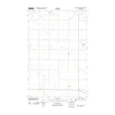
2010 Map of Marcoux Corners
USGS Topo · Published 2010About this map
Cyr Creek and Kripple Creek snake across this agricultural landscape in Red Lake County, defining a region defined by its watercourses and rural junctions. Small settlements like Perault and Delorme anchor the township grid, while Marcoux Corners serves as a key intersection in the southern portion of the survey. The terrain is marked by the confluence of the Red Lake River and Clearwater River in the northeast, where the Red Lake Falls Municipal Airport sits near the edge of the local valley. Genealogists and local researchers will find the Cyr Cemetery particularly notable, providing a specific point of reference for family histories in this part of Minnesota. The map details a dense network of county roads, such as County Hwy-11 and County Hwy-212, which illustrate the connectivity between these isolated agrarian communities and their proximity to larger regional hubs.
Find a feature on this map
23 named features on this map. Tap any name to fly to it.
Don’t see what you’re looking for? This feature index may not catch every label — zoom into the map to look around manually.
Map Details
Editions of this 2010 Marcoux Corners Map
This is the sole edition of this map. No revisions or reprints were ever made.
Other maps of this area

1918 · Terrebonne
USGS Topo · 1:62,500

1918 · Red Lake Falls
USGS Topo · 1:62,500

1919 · Valley
USGS Topo · 1:62,500

1952 · Red Lake Falls
USGS Topo · 1:62,500

1952 · Grand Forks
USGS Topo · 1:250,000

1956 · Grand Forks
USGS Topo · 1:250,000
1964 · Plummer NW
USGS Topo · 1:24,000

1964 · Terrebonne
USGS Topo · 1:24,000

1965 · Dugdale
USGS Topo · 1:24,000

1965 · Harold
USGS Topo · 1:24,000