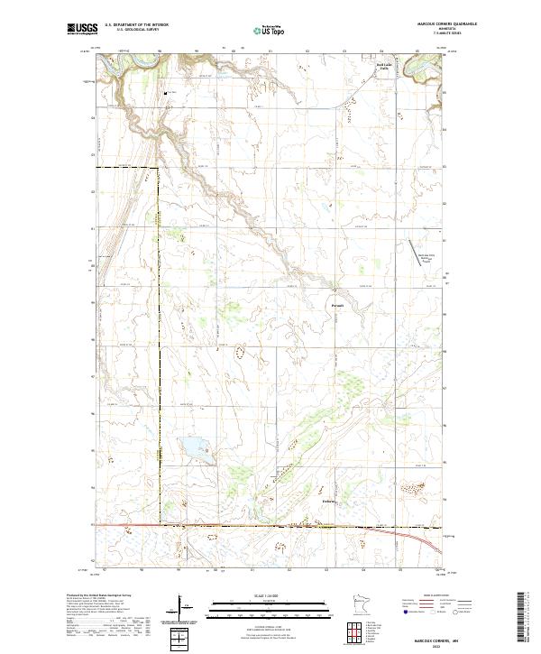
2022 Map of Marcoux Corners
USGS Topo · Published 2022About this map
The Red Lake River and Clearwater River converge in the northern portion of this landscape, marking a vital hydrographic junction near the settlement of Red Lake Falls. The terrain is defined by the transition across the Red Lake Co and Polk Co line, where the prairie-like expanse is punctuated by small water bodies like Seiger Group Pond and narrow drainages such as Cyr Cr.
Find a feature on this map
28 named features on this map. Tap any name to fly to it.
Don’t see what you’re looking for? This feature index may not catch every label — zoom into the map to look around manually.
Map Details
Editions of this 2022 Marcoux Corners Map
This is the sole edition of this map. No revisions or reprints were ever made.
Other maps of this area

1918 · Terrebonne
USGS Topo · 1:62,500

1918 · Red Lake Falls
USGS Topo · 1:62,500

1919 · Valley
USGS Topo · 1:62,500

1952 · Red Lake Falls
USGS Topo · 1:62,500

1952 · Grand Forks
USGS Topo · 1:250,000

1956 · Grand Forks
USGS Topo · 1:250,000
1964 · Plummer NW
USGS Topo · 1:24,000

1964 · Terrebonne
USGS Topo · 1:24,000

1965 · Dugdale
USGS Topo · 1:24,000

1965 · Harold
USGS Topo · 1:24,000