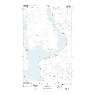
2011 Map of Marcus
USGS Topo · Published 2011About this map
Franklin D Roosevelt Lake dominates the landscape of this 2011 survey, where the Kettle River joins the main reservoir body. The town of Marcus and East Marcus sit along the eastern shore, supported by the Marcus Post Office and nearby Grandview Cemetery. The area's industrial history is well-documented through numerous mining sites tucked into the surrounding hills, including the Napoleon Mine to the north and the Gold Reef Mine and Gold Ledge Mine near Gold Hill. Transportation networks are visible via the SPCC Spur and Metneys Spurs, while recreational areas like Marcus Island Campground and Snag Cove Campground mark the contemporary use of the waterfront. Further south, the Kettle Falls Bridge provides a vital crossing near the small settlement of Harter.
Find a feature on this map
57 named features on this map. Tap any name to fly to it.
Don’t see what you’re looking for? This feature index may not catch every label — zoom into the map to look around manually.
Map Details
Editions of this 2011 Marcus Map
This is the sole edition of this map. No revisions or reprints were ever made.
Other maps of this area

1929 · Colville
USGS Topo · 1:125,000

1933 · Colville
USGS Topo · 1:125,000

1936 · Marcus
USGS Topo · 1:96,000

1942 · Marcus
USGS Topo · 1:125,000

1948 · Kettle Falls
USGS Topo · 1:62,500

1948 · Orient
USGS Topo · 1:62,500

1951 · Orient
USGS Topo · 1:62,500

1951 · Kettle Falls
USGS Topo · 1:62,500

1952 · Echo Valley
USGS Topo · 1:24,000

1952 · Colville
USGS Topo · 1:24,000