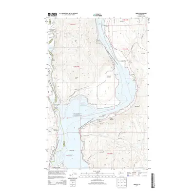
2014 Map of Marcus
USGS Topo · Published 2014About this map
Franklin D Roosevelt Lake dominates this northern Washington corridor, where the Columbia River valley was transformed by the Grand Coulee Dam. The settlements of Marcus and East Marcus sit along the southeastern banks, serving as focal points for the surrounding rural communities. To the north, the terrain rises toward Kelly Hill and Kelley Mtn, while the waterfront is characterized by recreational sites like Snag Cove Campground and the Marcus Island Campground.
Find a feature on this map
71 named features on this map. Tap any name to fly to it.
Don’t see what you’re looking for? This feature index may not catch every label — zoom into the map to look around manually.
Map Details
Editions of this 2014 Marcus Map
This is the sole edition of this map. No revisions or reprints were ever made.
Other maps of this area

1929 · Colville
USGS Topo · 1:125,000

1933 · Colville
USGS Topo · 1:125,000

1936 · Marcus
USGS Topo · 1:96,000

1942 · Marcus
USGS Topo · 1:125,000

1948 · Kettle Falls
USGS Topo · 1:62,500

1948 · Orient
USGS Topo · 1:62,500

1951 · Orient
USGS Topo · 1:62,500

1951 · Kettle Falls
USGS Topo · 1:62,500

1952 · Echo Valley
USGS Topo · 1:24,000

1952 · Colville
USGS Topo · 1:24,000