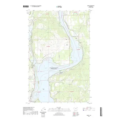
2020 Map of Marcus
USGS Topo · Published 2020About this map
Lake Roosevelt National Recreation Area dominates this landscape, where the waters of Franklin D Roosevelt Lake submerge the historic course of the upper Columbia River. The small community of Marcus sits along the southern shore, while the settlements of Evans and Powell are located further north along the eastern bank. The terrain is defined by significant elevations such as Kelly Hill and Bear Mountain, reflecting the area's transition between the river valley and upland forests.
Find a feature on this map
68 named features on this map. Tap any name to fly to it.
Don’t see what you’re looking for? This feature index may not catch every label — zoom into the map to look around manually.
Map Details
Editions of this 2020 Marcus Map
This is the sole edition of this map. No revisions or reprints were ever made.
Other maps of this area

1929 · Colville
USGS Topo · 1:125,000

1933 · Colville
USGS Topo · 1:125,000

1936 · Marcus
USGS Topo · 1:96,000

1942 · Marcus
USGS Topo · 1:125,000

1948 · Kettle Falls
USGS Topo · 1:62,500

1948 · Orient
USGS Topo · 1:62,500

1951 · Orient
USGS Topo · 1:62,500

1951 · Kettle Falls
USGS Topo · 1:62,500

1952 · Echo Valley
USGS Topo · 1:24,000

1952 · Colville
USGS Topo · 1:24,000