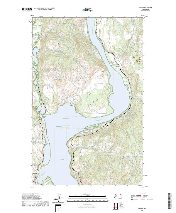
2023 Map of Marcus
USGS Topo · Published 2023About this map
Marcus sits along the eastern shore of the Columbia River within the Lake Roosevelt National Recreation Area, where the landscape is defined by the massive impoundment of the Franklin D Roosevelt Lake. This modern survey illustrates the contemporary settlement patterns of Stevens County, showing the small communities of Evans and Powell situated near the riverbanks. The map documents significant local landmarks such as Grandview Cem and Bossburg Cem, providing essential points of reference for genealogical research.
Find a feature on this map
67 named features on this map. Tap any name to fly to it.
Don’t see what you’re looking for? This feature index may not catch every label — zoom into the map to look around manually.
Map Details
Editions of this 2023 Marcus Map
This is the sole edition of this map. No revisions or reprints were ever made.
Historical Maps of Powell Through Time
4 maps found