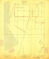
1910 Map of Marcuse
USGS Topo · Published 1910About this map
Marcuse sits as the primary settlement on this landscape, documented in a survey by W. H. Griffin and M. A. Knock during a time when the central Sacramento Valley relied heavily on local drainage systems and small rural nodes. The terrain is defined by the winding course of Nelson Slough and the presence of the Central School, which served the scattered agricultural families of the region. The map reveals the intricate township grid and the vast marshlands that characterized the area before modern reclamation projects fully transformed the valley floor. Researchers will find a clear record of early land divisions and the specific road networks connecting this part of Sutter County to neighboring districts.
Find a feature on this map
4 named features on this map. Tap any name to fly to it.
Don’t see what you’re looking for? This feature index may not catch every label — zoom into the map to look around manually.
Map Details
Editions of this 1910 Marcuse Map
3 editions found
Other maps of this area

1888 · Marysville
USGS Topo · 1:125,000

1891 · Marysville
USGS Topo · 1:125,000

1894 · Marysville
USGS Topo · 1:125,000

1895 · Marysville
USGS Topo · 1:125,000

1907 · Dunnigan
USGS Topo · 1:62,500

1910 · Knights Landing
USGS Topo · 1:31,680

1910 · Vernon
USGS Topo · 1:31,680

1910 · Nicolaus
USGS Topo · 1:31,680

1910 · Marcuse
USGS Topo · 1:31,680

1911 · Gilsizer Slough
USGS Topo · 1:31,680