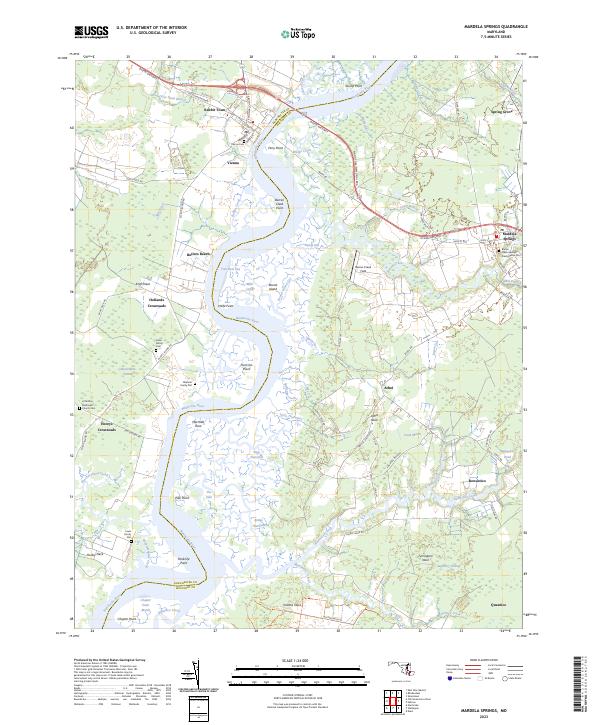
2023 Map of Mardela Springs
USGS Topo · Published 2023About this map
The Nanticoke River defines this landscape, separating Dorchester and Wicomico counties as it snakes toward the Chesapeake Bay. The historic town of Vienna sits at a critical crossing point near Ferry Point, where the Nanticoke Memorial Brg now carries modern travelers along the Ocean Gateway. The map is particularly rich in genealogical data, preserving the locations of numerous family-named landmarks and resting places such as the Oliphant Family Plot, Hahn Family Cem, and Lewis Family Plot. Further east, the community of Mardela Springs serves as a local hub, anchored by the Barren Creek Springs Presbyterian Cem. The shoreline is a complex network of marshes and guts, including Tom Fitch Gut and Round Island Gut, reflecting the enduring water-based geography of Maryland's Eastern Shore.
Find a feature on this map
98 named features on this map. Tap any name to fly to it.
Don’t see what you’re looking for? This feature index may not catch every label — zoom into the map to look around manually.
Map Details
Editions of this 2023 Mardela Springs Map
This is the sole edition of this map. No revisions or reprints were ever made.
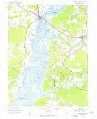
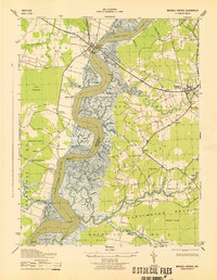
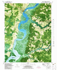
Historical Maps of Rabbit Town Through Time
4 maps found