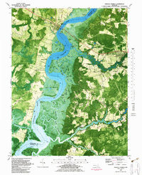
1982 Map of Mardela Springs
USGS Topo · Published 1983About this map
The Nanticoke River defines the landscape of the Delmarva Peninsula on this early 1980s orthophotomap, marking the boundary between Dorchester and Wicomico counties. The river's winding course is flanked by extensive marshlands and tidal features such as Point No Point and the complex channels of Bridge Thorofare. On the eastern bank, the town of Mardela Springs serves as a local hub, situated where the Barren Creek meets the tidal wetlands.
Find a feature on this map
80 named features on this map. Tap any name to fly to it.
Don’t see what you’re looking for? This feature index may not catch every label — zoom into the map to look around manually.
Map Details
Editions of this 1982 Mardela Springs Map
This is the sole edition of this map. No revisions or reprints were ever made.
Other maps of this area

1901 · Salisbury
USGS Topo · 1:62,500

1903 · Nanticoke
USGS Topo · 1:62,500

1905 · Hurlock
USGS Topo · 1:62,500

1915 · Seaford
USGS Topo · 1:62,500

1942 · Wetipquin
USGS Topo · 1:24,000

1942 · Mardela Springs
USGS Topo · 1:24,000

1942 · Eden
USGS Topo · 1:24,000

1942 · Hebron
USGS Topo · 1:24,000
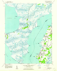
1942 · Nanticoke
USGS Topo · 1:24,000
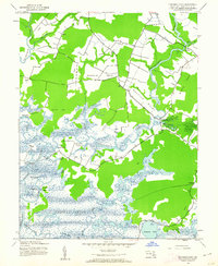
1942 · Chicamacomico
USGS Topo · 1:24,000