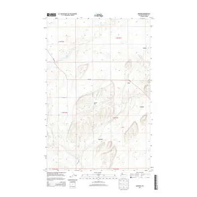
2013 Map of Marengo
USGS Topo · Published 2013About this map
Cow Cr winds through a landscape of coulees and high plateaus in this eastern Washington survey. The terrain is dominated by the Marengo Hills, where the drainage patterns of the Scablands are clearly visible in the relief. Small rural clusters like Marengo and Teske are linked by a network of early transit routes, most notably the Old Military Rd, which cuts diagonally across the eastern townships. This corridor reflects the historical movement of settlers and military personnel through Adams County. Other scattered points of interest include Finnell Lake to the northwest and minor localities such as Emden, Carlmar, and Gillespie. The road network, including McCall Rd and N Cow Creek Rd, follows the section lines of the Public Land Survey System, illustrating the methodical division of the wheat-growing country.
Find a feature on this map
20 named features on this map. Tap any name to fly to it.
Don’t see what you’re looking for? This feature index may not catch every label — zoom into the map to look around manually.
Map Details
Editions of this 2013 Marengo Map
This is the sole edition of this map. No revisions or reprints were ever made.
Other maps of this area

1923 · Washtucna
USGS Topo · 1:62,500

1925 · Washtucna
USGS Topo · 1:62,500

1950 · Benge
USGS Topo · 1:62,500

1952 · Benge
USGS Topo · 1:62,500

1953 · Walla Walla
USGS Topo · 1:250,000

1953 · Ritzville
USGS Topo · 1:250,000

1958 · Walla Walla
USGS Topo · 1:250,000

1959 · Ritzville
USGS Topo · 1:250,000

1964 · Karakul Hills
USGS Topo · 1:24,000

1964 · Macall
USGS Topo · 1:24,000