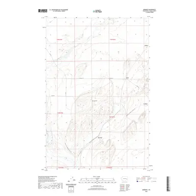
2020 Map of Marengo
USGS Topo · Published 2020About this map
The Marengo Hills dominate this portion of Adams County, where the dry landscape is bisected by the winding course of Cow Cr. Small rural settlements like Marengo, Teske, Carlmar, and Emden are connected by a grid of county roads including Harder Rd and N Marengo Rd. A significant modern feature is the Palouse To Cascades State Park Trail, which follows a former railroad alignment through the hills and across the creek. This infrastructure pattern illustrates the area's transition from a rail-dependent agricultural corridor to one focused on recreational trails. The map detail provides a clear view of the complex topography and the sparse, purposeful placement of farmsteads and rural junctions in this part of eastern Washington.
Find a feature on this map
20 named features on this map. Tap any name to fly to it.
Don’t see what you’re looking for? This feature index may not catch every label — zoom into the map to look around manually.
Map Details
Editions of this 2020 Marengo Map
This is the sole edition of this map. No revisions or reprints were ever made.
Other maps of this area

1923 · Washtucna
USGS Topo · 1:62,500

1925 · Washtucna
USGS Topo · 1:62,500

1950 · Benge
USGS Topo · 1:62,500

1952 · Benge
USGS Topo · 1:62,500

1953 · Walla Walla
USGS Topo · 1:250,000

1953 · Ritzville
USGS Topo · 1:250,000

1958 · Walla Walla
USGS Topo · 1:250,000

1959 · Ritzville
USGS Topo · 1:250,000

1964 · Karakul Hills
USGS Topo · 1:24,000

1964 · Macall
USGS Topo · 1:24,000