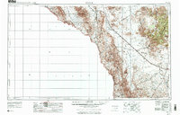
1959 Map of Marfa
USGS Topo · Published 1976About this map
The Sierra Vieja and Van Horn Mountains dominate this 1959 Trans-Pecos survey, revealing a landscape defined by sharp elevation changes and the deep corridor of the Rio Grande. Life in this high-desert region follows the path of the Southern Pacific railroad, which links the isolated settlements of Valentine and Lobo across the Lobo Valley. The map records a time of sparse ranching and remote outposts, including the Indian Hot Springs Resort near the river and the lonely Quebec Siding.
Find a feature on this map
35 named features on this map. Tap any name to fly to it.
Don’t see what you’re looking for? This feature index may not catch every label — zoom into the map to look around manually.
Map Details
Editions of this 1959 Marfa Map
2 editions found

Other maps of this area

1892 · Chispa
USGS Topo · 1:125,000

1894 · Fort Hancock
USGS Topo · 1:125,000

1894 · Valentine
USGS Topo · 1:125,000

1894 · Fort Davis
USGS Topo · 1:125,000

1895 · Chispa
USGS Topo · 1:125,000

1895 · Marfa
USGS Topo · 1:125,000

1895 · Sierra Blanca
USGS Topo · 1:125,000

1895 · Alpine
USGS Topo · 1:125,000

1896 · Ruidosa
USGS Topo · 1:125,000

1896 · San Carlos
USGS Topo · 1:125,000