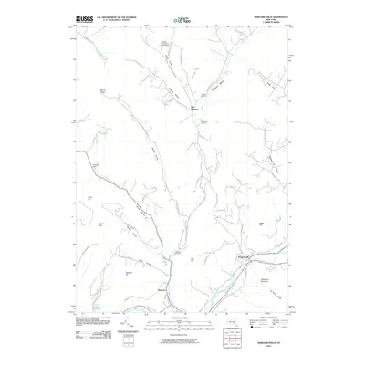
2010 Map of Margaretville
USGS Topo · Published 2010About this map
Margaretville sits at the convergence of the East Branch Delaware River and Bryants Brook, serving as a central hub for this portion of Delaware County. The landscape is defined by its deep hollows and high ridges, where narrow roads like Winter Hollow Rd and Weaver Hollow Rd follow the natural drainage of the Catskill Mountains. Small settlements such as New Kingston and Dunraven are tucked into these valleys, maintaining their character as isolated mountain communities.
Find a feature on this map
68 named features on this map. Tap any name to fly to it.
Don’t see what you’re looking for? This feature index may not catch every label — zoom into the map to look around manually.
Map Details
Editions of this 2010 Margaretville Map
This is the sole edition of this map. No revisions or reprints were ever made.
Other maps of this area

1901 · Margaretville
USGS Topo · 1:62,500

1904 · Hobart
USGS Topo · 1:62,500

1904 · Margaretville
USGS Topo · 1:62,500

1909 · Delhi
USGS Topo · 1:62,500

1911 · Delhi
USGS Topo · 1:62,500

1922 · Andes
USGS Topo · 1:62,500

1924 · Andes
USGS Topo · 1:62,500

1943 · Bloomville
USGS Topo · 1:24,000
1945 · Seager
USGS Topo · 1:24,000

1945 · Fleischmanns
USGS Topo · 1:24,000