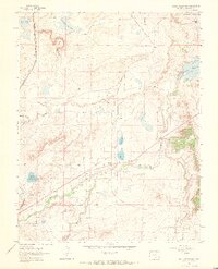
1963 Map of Maria Reservoir
USGS Topo · Published 1966About this map
Maria Reservoir and the Cucharas River corridor anchor this mid-century look at Huerfano County's high plains water management. The landscape is defined by an intricate network of irrigation, including the Duran Ditch, Holita Ditch, and Gomez Ditch, which redirect water across the arid terrain to support local ranching and agriculture. The convergence of transit and geography is clear at Cuchara Junction, where the Denver and Rio Grande Southern railroad once influenced the local economy. Genealogists will find significant value in the family-named burial sites located across the quadrangle, such as Vigil Cem, Valdez Cem, and Bustos Cem. These cemeteries, along with landmarks like Bradford Mesa and Valdez Lake, provide a detailed record of the families and landholders who shaped this portion of Southern Colorado.
Find a feature on this map
26 named features on this map. Tap any name to fly to it.
Don’t see what you’re looking for? This feature index may not catch every label — zoom into the map to look around manually.
Map Details
Editions of this 1963 Maria Reservoir Map
2 editions found
Other maps of this area

1891 · Walsenburg
USGS Topo · 1:125,000

1894 · Walsenburg
USGS Topo · 1:125,000

1897 · Walsenburg
USGS Topo · 1:125,000

1900 · Walsenburg
USGS Topo · 1:125,000

1954 · Trinidad
USGS Topo · 1:250,000

1955 · Trinidad
USGS Topo · 1:250,000

1958 · Trinidad
USGS Topo · 1:250,000

1959 · Trinidad
USGS Topo · 1:250,000
1963 · Walsenburg South
USGS Topo · 1:24,000
1963 · Walsenburg North
USGS Topo · 1:24,000