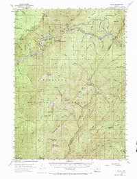
1954 Map of Marial
USGS Topo · Published 1984About this map
Marial sits along the Rogue River in this mid-century survey of the Siskiyou National Forest. The landscape is defined by the deep canyons of the Rogue, where numerous gravel bars and landings like Half Moon Bar, Blossom Bar, and Solitude Bar mark the river's course through the western Cascades. This era reflects a rugged, interior wilderness accessible primarily by trails and water, before extensive modern road development.
Find a feature on this map
97 named features on this map. Tap any name to fly to it.
Don’t see what you’re looking for? This feature index may not catch every label — zoom into the map to look around manually.
Map Details
Editions of this 1954 Marial Map
4 editions found

Other maps of this area

1899 · Port Orford
USGS Topo · 1:125,000

1903 · Port Orford
USGS Topo · 1:125,000

1917 · Kerby
USGS Topo · 1:125,000

1918 · Kerby
USGS Topo · 1:125,000

1945 · Kerby
USGS Topo · 1:125,000

1946 · Galice
USGS Topo · 1:62,500

1946 · Dutchman Butte
USGS Topo · 1:62,500

1948 · Galice
USGS Topo · 1:62,500

1948 · Dutchman Butte
USGS Topo · 1:62,500

1954 · Coos Bay
USGS Topo · 1:250,000