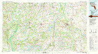
1979 Map of Marianna
USGS Topo · Published 1980About this map
The Chipola River corridor anchors this regional study of the Florida Panhandle and the tri-state borderlands of Alabama and Georgia. This 1970s landscape is defined by the convergence of major transportation arteries, including the Louisville and Nashville and Atlanta and St Andrews Bay railroads, which linked established towns like Marianna, Chipley, and Bonifay. The map captures a moment when rural crossroads such as Two Egg and Lovedale persisted alongside growing municipal infrastructure like Marianna Municipal Airport. Notable for genealogists and local historians are the numerous small settlements and water features, from Merritts Mill Pond to the subterranean interest of Florida Caverns State Park. The intricate network of county roads connecting Graceville, Cottondale, and Sneads illustrates a well-settled agricultural and timber interior before modern expansion altered the character of these historic communities.
Find a feature on this map
86 named features on this map. Tap any name to fly to it.
Don’t see what you’re looking for? This feature index may not catch every label — zoom into the map to look around manually.
Map Details
Editions of this 1979 Marianna Map
2 editions found
Other maps of this area

1935 · De Funiak Springs
USGS Topo · 1:48,000

1936 · Point Washington
USGS Topo · 1:48,000

1938 · De Funiak Springs
USGS Topo · 1:62,500

1939 · Point Washington
USGS Topo · 1:62,500

1942 · Enterprise
USGS Topo · 1:125,000

1944 · Clarksville
USGS Topo · 1:31,680

1944 · Crystal Lake
USGS Topo · 1:24,000

1944 · Bruce
USGS Topo · 1:24,000

1944 · Bennett
USGS Topo · 1:24,000

1945 · Juniper Creek
USGS Topo · 1:31,680