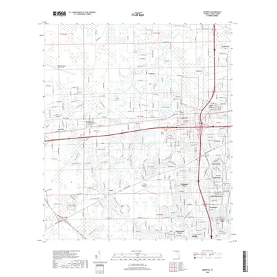
2018 Map of Marietta
USGS Topo · Published 2018About this map
The aviation footprint of western Jacksonville is prominently displayed here, anchored by the sprawling Whitehouse Naval Outlying Field and the Herlong Recreational Airport. This 2018 survey detail provides a clear view of the transition from industrial corridors near the CSX Transportation lines to established residential neighborhoods. Subdivisions like Normandy Village, Sweetwater, and Cedar Hills Estates fill the southern half of the quadrangle, while the northern reaches maintain a more open character with settlements like Cambon and Langmar. Waterways such as the Cedar River and McGirts Creek wind through these communities, providing a natural drainage system for the low-lying terrain. Local history is preserved in several small burial grounds, including Sellers Cem and Pinkston Cem, which sit alongside modern institutions like Trinity Baptist College.
Find a feature on this map
315 named features on this map. Tap any name to fly to it.
Don’t see what you’re looking for? This feature index may not catch every label — zoom into the map to look around manually.
Map Details
Editions of this 2018 Marietta Map
This is the sole edition of this map. No revisions or reprints were ever made.
Other maps of this area

1917 · Orange Park
USGS Topo · 1:62,500

1917 · Cambon
USGS Topo · 1:62,500

1918 · Middleburg
USGS Topo · 1:62,500

1918 · Cambon
USGS Topo · 1:62,500

1918 · Jacksonville
USGS Topo · 1:62,500

1918 · Orange Park
USGS Topo · 1:62,500

1941 · Middleburg
USGS Topo · 1:62,500

1948 · Jacksonville
USGS Topo · 1:250,000

1949 · Fiftone
USGS Topo · 1:24,000

1949 · Jacksonville Heights
USGS Topo · 1:24,000
Featured Places
- Jacksonville, FL
- Cambon, Jacksonville
- Hart Haven, Jacksonville
- Hyde Grove, Jacksonville
- Jacksonville Heights, Jacksonville