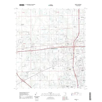
2021 Map of Marietta
USGS Topo · Published 2021About this map
Whitehouse Naval Outlying Field and the Herlong Recreational Airport anchor the western suburbs of Jacksonville, highlighting a landscape shaped by aviation and military infrastructure. This western corridor of Duval County demonstrates a transition from more open terrain near Halsema and Whitehouse to the dense residential grids of Lackawanna and Hyde Grove. The Jacksonville Baldwin Rail Trl follows a historic rail path through the heart of the region, passing north of Pinkston Cem and the small settlement of Cambon. Along the Cedar River and McGirts Cr, suburban development meets natural drainage systems, while established neighborhoods like Marietta and Sweetwater show the infill of the late 20th century. Local landmarks like Trinity Baptist College and several small burial grounds, including Sellers Cem and Parrish Cem, provide specific points of interest for genealogists and local historians.
Find a feature on this map
133 named features on this map. Tap any name to fly to it.
Don’t see what you’re looking for? This feature index may not catch every label — zoom into the map to look around manually.
Map Details
Editions of this 2021 Marietta Map
This is the sole edition of this map. No revisions or reprints were ever made.
Other maps of this area

1917 · Orange Park
USGS Topo · 1:62,500

1917 · Cambon
USGS Topo · 1:62,500

1918 · Middleburg
USGS Topo · 1:62,500

1918 · Cambon
USGS Topo · 1:62,500

1918 · Jacksonville
USGS Topo · 1:62,500

1918 · Orange Park
USGS Topo · 1:62,500

1941 · Middleburg
USGS Topo · 1:62,500

1948 · Jacksonville
USGS Topo · 1:250,000

1949 · Fiftone
USGS Topo · 1:24,000

1949 · Jacksonville Heights
USGS Topo · 1:24,000
Featured Places
- Jacksonville, FL
- Cambon, Jacksonville
- Hart Haven, Jacksonville
- Hyde Grove, Jacksonville
- Jacksonville Heights, Jacksonville