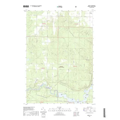
2019 Map of Marilla
USGS Topo · Published 2019About this map
Manistee National Forest encompasses the majority of this landscape in northern Michigan, where the waters of the Manistee Wild and Scenic River dominate the southern topography. The river is central to the area's development, featuring the Tippy Dam and the expansive Tippy Dam Pond, which is dotted with several named landforms including Government Island, Fitch Island, and Birch Island. To the north, the settlement of Marilla marks a hub of rural roads like Nine Mile Rd and Marilla Rd. This 2019 survey documents a region defined by its conservation and recreation infrastructure, from the N Country National Scenic Trail winding through the woods to smaller water bodies such as Dickson Lake and Leitch Bayou. The map illustrates how decades of federal forest management have preserved the primitive character of the glacial terrain and river valleys.
Find a feature on this map
49 named features on this map. Tap any name to fly to it.
Don’t see what you’re looking for? This feature index may not catch every label — zoom into the map to look around manually.
Map Details
Editions of this 2019 Marilla Map
This is the sole edition of this map. No revisions or reprints were ever made.
Other maps of this area

1933 · Peacock NE
USGS Topo · 1:31,680

1933 · Peacock NW
USGS Topo · 1:31,680

1954 · Traverse City
USGS Topo · 1:250,000

1954 · Manitowoc
USGS Topo · 1:250,000

1956 · Onekama
USGS Topo · 1:62,500

1957 · Freesoil
USGS Topo · 1:62,500

1957 · Copemish
USGS Topo · 1:62,500

1957 · Wellston
USGS Topo · 1:62,500

1958 · Traverse City
USGS Topo · 1:250,000

1958 · Manitowoc
USGS Topo · 1:250,000