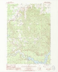
1987 Map of Marilla
USGS Topo · Published 1988About this map
Marilla and the surrounding woodlands of the Dickson Manistee National Forest define this landscape in the late 1980s. The map captures the complex hydrology of the region, where the Manistee River winds through the southern terrain toward the engineering of Tippy Dam and the expansive Tippy Dam Pond. Along the river, features like Leitch Bayou provide specific points of interest for local history and river navigation.
Find a feature on this map
16 named features on this map. Tap any name to fly to it.
Don’t see what you’re looking for? This feature index may not catch every label — zoom into the map to look around manually.
Map Details
Editions of this 1987 Marilla Map
2 editions found
Other maps of this area

1933 · Peacock NE
USGS Topo · 1:31,680

1933 · Peacock NW
USGS Topo · 1:31,680

1954 · Traverse City
USGS Topo · 1:250,000

1954 · Manitowoc
USGS Topo · 1:250,000

1956 · Onekama
USGS Topo · 1:62,500

1957 · Freesoil
USGS Topo · 1:62,500

1957 · Copemish
USGS Topo · 1:62,500

1957 · Wellston
USGS Topo · 1:62,500

1958 · Traverse City
USGS Topo · 1:250,000

1958 · Manitowoc
USGS Topo · 1:250,000