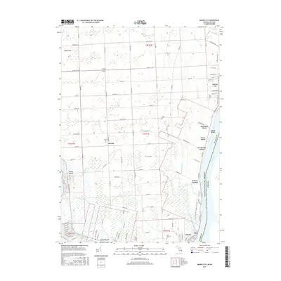
2017 Map of Marine City
USGS Topo · Published 2017About this map
The Saint Clair River defines the eastern edge of this landscape, serving as the international boundary between the United States and Canada. Along its banks, several riverfront communities such as Marine City, Roberts Landing, and Martindale Beach are connected by the River Rd and the Bridge to Bay Trail. The interior land is characterized by a dense network of drainage channels, including the Beaverdam Drain and Marine City Drain, which support the low-lying terrain near the northern reaches of Lake Saint Clair.
Find a feature on this map
107 named features on this map. Tap any name to fly to it.
Don’t see what you’re looking for? This feature index may not catch every label — zoom into the map to look around manually.
Map Details
Editions of this 2017 Marine City Map
This is the sole edition of this map. No revisions or reprints were ever made.
Other maps of this area

1912 · Port Huron
USGS Topo · 1:62,500

1914 · Algonac
USGS Topo · 1:62,500

1928 · Hicky
USGS Topo · 1:62,500

1929 · Port Huron
USGS Topo · 1:62,500

1936 · St. Clair
USGS Topo · 1:31,680

1936 · Rattle Run
USGS Topo · 1:31,680

1936 · New Baltimore
USGS Topo · 1:31,680

1936 · Algonac
USGS Topo · 1:31,680

1939 · New Baltimore
USGS Topo · 1:24,000

1939 · Adair
USGS Topo · 1:24,000