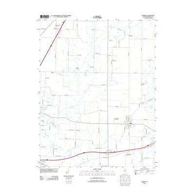
2012 Map of Marine
USGS Topo · Published 2012About this map
Marine serves as the primary hub in this portion of Madison County, established where several regional roads converge. The landscape is defined by the drainage of Silver Cr, which winds south toward Sportsmans Lake. This survey is particularly valuable for genealogists, as it preserves the locations of numerous family and denominational burial grounds tucked away in the countryside, including the Wood Family Cem, Seybert Family Cem, and Crandall Family Cem. To the north, the small settlements of Fruit and Kaufman illustrate the area's rural character, while Neudeckers Mountain stands out as a rare named topographic feature in the relatively level terrain. The network of local routes like Staunton Rd and Alhambra Rd provides a clear view of the township’s physical layout in the early 21st century.
Find a feature on this map
82 named features on this map. Tap any name to fly to it.
Don’t see what you’re looking for? This feature index may not catch every label — zoom into the map to look around manually.
Map Details
Editions of this 2012 Marine Map
This is the sole edition of this map. No revisions or reprints were ever made.
Other maps of this area

1906 · Breese
USGS Topo · 1:62,500

1907 · Breese
USGS Topo · 1:62,500

1907 · Belleville
USGS Topo · 1:62,500

1927 · Edwardsville
USGS Topo · 1:62,500

1932 · Edwardsville
USGS Topo · 1:62,500

1937 · Collinsville
USGS Topo · 1:24,000

1937 · New Douglas
USGS Topo · 1:48,000

1944 · New Douglas
USGS Topo · 1:62,500

1949 · St. Jacob
USGS Topo · 1:24,000

1950 · Edwardsville
USGS Topo · 1:24,000