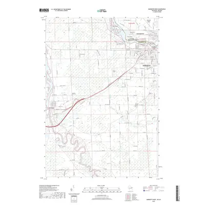
2018 Map of Marinette West
USGS Topo · Published 2018About this map
The Menominee River serves as the geographic and industrial spine of this borderland, where the interstate line divides Menominee, Michigan, from Marinette, Wisconsin. This late-stage survey details a landscape defined by its riverine geography, featuring a series of named islands like Stephenson Island, Boom Island, and Blueberry Island that historically supported the region's timber and milling heritage. The concentration of cemetery sites on the Wisconsin side, including Forest Home Cem, Woodlawn Cem, Hebrew Cem, and Calvary Cem, provides a significant record for genealogical research in these sister cities.
Find a feature on this map
136 named features on this map. Tap any name to fly to it.
Don’t see what you’re looking for? This feature index may not catch every label — zoom into the map to look around manually.
Map Details
Editions of this 2018 Marinette West Map
This is the sole edition of this map. No revisions or reprints were ever made.
Other maps of this area

1939 · Marinette
USGS Topo · 1:48,000

1939 · Porterfield
USGS Topo · 1:48,000

1942 · Porterfield
USGS Topo · 1:48,000

1954 · Escanaba
USGS Topo · 1:250,000

1954 · Manitowoc
USGS Topo · 1:250,000

1956 · Oconto
USGS Topo · 1:62,500

1957 · Escanaba
USGS Topo · 1:250,000

1958 · Escanaba
USGS Topo · 1:250,000

1958 · Manitowoc
USGS Topo · 1:250,000

1961 · Little Sturgeon
USGS Topo · 1:62,500