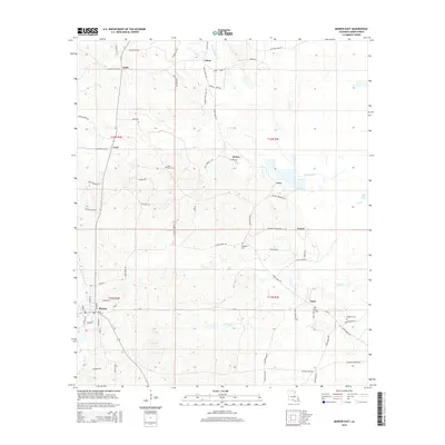
2015 Map of Marion East
USGS Topo · Published 2015About this map
Marion serves as a primary settlement hub in this portion of Union Parish, situated where several local roads converge amidst a landscape defined by tributary systems like Glaze Cr and Cecil Creek. The area is characterized by a dense network of family-named roads, including Riley Trestle Rd and Watson James Rd, which connect small communities such as Litroe, Bemis, and Dean. This road network suggests a history of localized agricultural or timber-related land use, further reinforced by the presence of Gravel and numerous rural homestead locations. For those tracking family history, the map provides precise locations for Saint Pauls Cem, Dean Cem, and multiple sites for Reppond Cem. To the north, the Mason Dixon Line Rd indicates the boundary proximity, while water features like Big Lake and Frank Lapere Cr shape the low-lying terrain of the northeast corner.
Find a feature on this map
71 named features on this map. Tap any name to fly to it.
Don’t see what you’re looking for? This feature index may not catch every label — zoom into the map to look around manually.
Map Details
Editions of this 2015 Marion East Map
This is the sole edition of this map. No revisions or reprints were ever made.
Other maps of this area

1933 · Strong
USGS Topo · 1:62,500

1934 · Felsenthal
USGS Topo · 1:62,500

1935 · Haile
USGS Topo · 1:62,500

1937 · Strong
USGS Topo · 1:62,500

1937 · Felsenthal
USGS Topo · 1:62,500

1938 · Felsenthal
USGS Topo · 1:62,500

1939 · Felsenthal
USGS Topo · 1:62,500

1939 · Strong
USGS Topo · 1:62,500

1952 · Farmerville
USGS Topo · 1:62,500

1953 · El Dorado
USGS Topo · 1:250,000