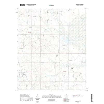
2018 Map of Marion East
USGS Topo · Published 2018About this map
Marion occupies the southwest corner of this Union Parish landscape, serving as a focal point for a network of parish roads and state routes that thread through the timberland and wetlands of northern Louisiana. The terrain is defined by the winding paths of Glaze Cr and Cecil Cr, which drain toward Big Lake in the east. Small, scattered settlements like Litroe, Bemis, and Dean suggest a history of rural community life tied to the land. Genealogists will find significant value in the documentation of local burial sites, including Saint Pauls Cem, Reppond Cem, and Dean Cem, often located near namesake roads like Saint Pauls Church Rd. The map also preserves local identifiers such as the Mason Dixon Line Rd near the northern border and the industry-suggestive Gravel area, reflecting the region's geographic and economic character.
Find a feature on this map
72 named features on this map. Tap any name to fly to it.
Don’t see what you’re looking for? This feature index may not catch every label — zoom into the map to look around manually.
Map Details
Editions of this 2018 Marion East Map
This is the sole edition of this map. No revisions or reprints were ever made.
Other maps of this area

1933 · Strong
USGS Topo · 1:62,500

1934 · Felsenthal
USGS Topo · 1:62,500

1935 · Haile
USGS Topo · 1:62,500

1937 · Strong
USGS Topo · 1:62,500

1937 · Felsenthal
USGS Topo · 1:62,500

1938 · Felsenthal
USGS Topo · 1:62,500

1939 · Felsenthal
USGS Topo · 1:62,500

1939 · Strong
USGS Topo · 1:62,500

1952 · Farmerville
USGS Topo · 1:62,500

1953 · El Dorado
USGS Topo · 1:250,000