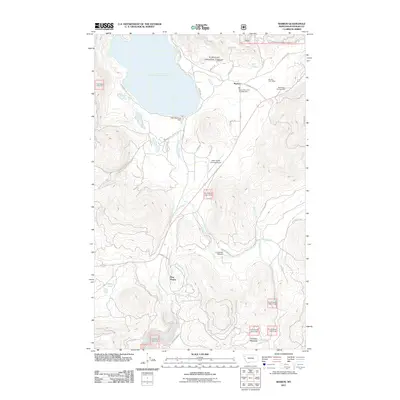
2011 Map of Marion
USGS Topo · Published 2011About this map
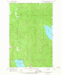
Little Bitterroot Lake dominates the northwest corner of this 2011 survey, serving as the headwaters for the Little Bitterroot River which flows southward past the Little Bitterroot Dam. The settlement of Marion is a central hub for the surrounding landscape, anchored by the Marion Post Office and the Marion Rural Fire Dist Battalion 1. The drainage patterns are clearly defined by Sickler Creek and Granger Creek, which carve through the terrain toward Granger Meadow in the southeast.
Find a feature on this map
36 named features on this map. Tap any name to fly to it.
Don’t see what you’re looking for? This feature index may not catch every label — zoom into the map to look around manually.
Map Details
Editions of this 2011 Marion Map
This is the sole edition of this map. No revisions or reprints were ever made.
Other maps of this area

1956 · Wallace
USGS Topo · 1:250,000

1957 · Kalispell
USGS Topo · 1:250,000

1960 · Kalispell
USGS Topo · 1:250,000

1960 · Wallace
USGS Topo · 1:250,000

1961 · Kalispell
USGS Topo · 1:250,000
1964 · Lone Lake
USGS Topo · 1:24,000
1964 · Haskill Mountain
USGS Topo · 1:24,000
1964 · Kofford Ridge
USGS Topo · 1:24,000
1964 · Pleasant Valley Mountain
USGS Topo · 1:24,000

1964 · Hubbart Reservoir
USGS Topo · 1:24,000