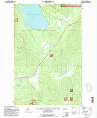
1994 Map of Marion
USGS Topo · Published 1996About this map
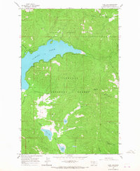
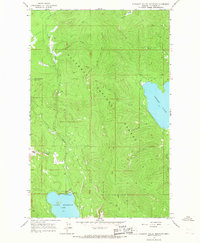
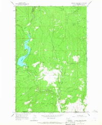
Little Bitterroot Lake dominates the northern reaches of this mid-1990s landscape, providing a focal point for the settlement at Marion. Located within the Salish Mountains, the area is characterized by a mix of public and private lands, including significant portions of the Flathead National Forest. The geography is defined by a complex drainage system where the Little Bitterroot River and tributaries like Sickler Creek and Granger Creek weave through the timbered terrain.
Find a feature on this map
14 named features on this map. Tap any name to fly to it.
Don’t see what you’re looking for? This feature index may not catch every label — zoom into the map to look around manually.
Map Details
Editions of this 1994 Marion Map
This is the sole edition of this map. No revisions or reprints were ever made.
Other maps of this area

1956 · Wallace
USGS Topo · 1:250,000

1957 · Kalispell
USGS Topo · 1:250,000

1960 · Kalispell
USGS Topo · 1:250,000

1960 · Wallace
USGS Topo · 1:250,000

1961 · Kalispell
USGS Topo · 1:250,000
1964 · Lone Lake
USGS Topo · 1:24,000
1964 · Haskill Mountain
USGS Topo · 1:24,000
1964 · Kofford Ridge
USGS Topo · 1:24,000
1964 · Pleasant Valley Mountain
USGS Topo · 1:24,000
1964 · Hubbart Reservoir
USGS Topo · 1:24,000