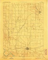
1889 Map of Marion
USGS Topo · Published 1907About this map
Marion stands as a significant rail hub in Linn County at the close of the 19th century, with a dense grid of streets and industry radiating from the Chicago Milwaukee and St. Paul Railroad. The landscape is defined by its deep connectivity, where major rail lines such as the Illinois Central Railroad slice diagonally through the prairie to reach northern settlements like Central City along the Wapsipinicon River.
Find a feature on this map
20 named features on this map. Tap any name to fly to it.
Don’t see what you’re looking for? This feature index may not catch every label — zoom into the map to look around manually.
Map Details
Editions of this 1889 Marion Map
3 editions found
Other maps of this area

1887 · Cedar Rapids
USGS Topo · 1:62,500

1888 · Shellsburg
USGS Topo · 1:62,500

1888 · Marion
USGS Topo · 1:62,500

1888 · Amana
USGS Topo · 1:62,500

1889 · Marion
USGS Topo · 1:62,500

1889 · Amana
USGS Topo · 1:62,500

1889 · Shellsburg
USGS Topo · 1:62,500

1890 · Anamosa
USGS Topo · 1:62,500

1891 · Mechanicsville
USGS Topo · 1:62,500

1891 · Cedar Rapids
USGS Topo · 1:62,500