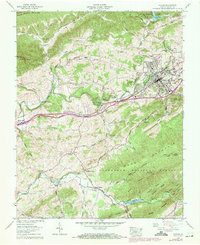
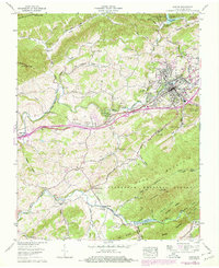
1958 Map of Marion
USGS Topo · Published 1971About this map
The Middle Fork Holston River and South Fork Holston River carve through this section of Smyth County, defining a landscape of narrow valleys and ridge lines between Walker Mountain and Pond Mountain. This survey captures the mid-century development of Marion, centered around the Norfolk and Western railway and Lee Highway. Educational and social institutions of the era are prominent, including the grounds of Marion College and the Southwestern State Hospital.
Find a feature on this map
63 named features on this map. Tap any name to fly to it.
Don’t see what you’re looking for? This feature index may not catch every label — zoom into the map to look around manually.
Map Details
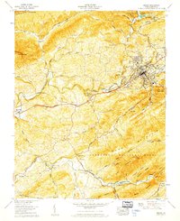
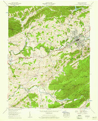
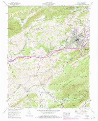
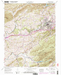
Editions of this 1958 Marion Map
6 editions found
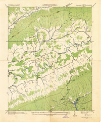
Other maps of this area

1889 · Wytheville
USGS Topo · 1:125,000

1891 · Abingdon
USGS Topo · 1:125,000

1892 · Wytheville
USGS Topo · 1:125,000

1894 · Abingdon
USGS Topo · 1:125,000

1909 · Abingdon
USGS Topo · 1:96,000

1911 · Abingdon
USGS Topo · 1:125,000

1931 · Rural Retreat
USGS Topo · 1:48,000
1934 · Chatham Hill
USGS Topo · 1:24,000

1935 · Konnarock
USGS Topo · 1:24,000

1935 · Chilhowie
USGS Topo · 1:24,000