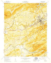
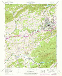
1958 Map of Marion
USGS Topo · Published 1960About this map
Marion serves as the focal point of this late 1950s survey, situated along the Middle Fork Holston River and the transit corridor defined by the Norfolk and Western railway and Lee Highway. The town's institutional footprint is substantial, featuring the Southwestern State Hospital and Marion College. The landscape is notably shaped by state and federal land management, with Hungry Mother State Park to the north and the expansive Jefferson National Forest covering the high ridges of Pond Mountain. Rural life is detailed through numerous small community centers such as McMullin, Seven Mile Ford, and the remote Quebec settlement. Conservation and industry are represented by the Marion State Fish Hatchery and Buller Bass Hatchery, while the presence of Holston Mills and a rock quarry points to the local extraction and processing economy.
Find a feature on this map
72 named features on this map. Tap any name to fly to it.
Don’t see what you’re looking for? This feature index may not catch every label — zoom into the map to look around manually.
Map Details
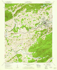
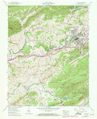
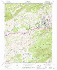
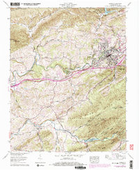
Editions of this 1958 Marion Map
6 editions found
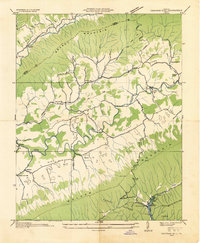
Other maps of this area

1889 · Wytheville
USGS Topo · 1:125,000

1891 · Abingdon
USGS Topo · 1:125,000

1892 · Wytheville
USGS Topo · 1:125,000

1894 · Abingdon
USGS Topo · 1:125,000

1909 · Abingdon
USGS Topo · 1:96,000

1911 · Abingdon
USGS Topo · 1:125,000

1931 · Rural Retreat
USGS Topo · 1:48,000
1934 · Chatham Hill
USGS Topo · 1:24,000

1935 · Konnarock
USGS Topo · 1:24,000

1935 · Chilhowie
USGS Topo · 1:24,000