
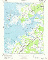
1942 Map of Marion
USGS Topo · Published 1958About this map
The salt marshes and tidal creeks of Somerset County define this coastal landscape during the early 1940s. The Pennsylvania (Crisfield Branch) railroad cuts a diagonal line through the marshy terrain, connecting the inland village of Marion with the waterfront community of Hopewell. This transportation corridor was vital for the local seafood and agricultural economy, linking the Eastern Shore to broader markets.
Find a feature on this map
82 named features on this map. Tap any name to fly to it.
Don’t see what you’re looking for? This feature index may not catch every label — zoom into the map to look around manually.
Map Details
Editions of this 1942 Marion Map
2 editions found
Other maps of this area

1903 · Crisfield
USGS Topo · 1:62,500

1903 · Deal Island
USGS Topo · 1:62,500

1920 · Crisfield
USGS Topo · 1:62,500

1942 · Terrapin Sand Point
USGS Topo · 1:24,000

1942 · Great Fox Island
USGS Topo · 1:24,000

1942 · Deal Island
USGS Topo · 1:24,000

1942 · Monie
USGS Topo · 1:24,000

1942 · Kingston
USGS Topo · 1:24,000

1942 · Princess Anne
USGS Topo · 1:24,000

1942 · Saxis
USGS Topo · 1:24,000