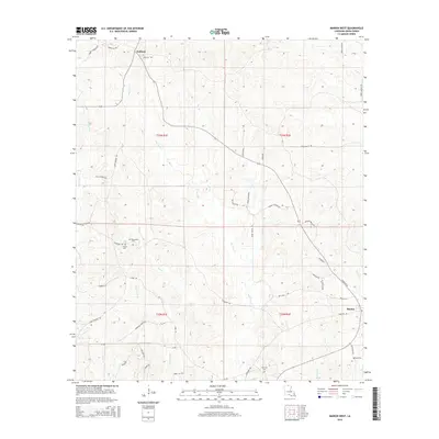
2015 Map of Marion West
USGS Topo · Published 2015About this map
Big Cane Creek and its many tributaries, including Dry Branch and Little Cane Creek, carve a detailed drainage pattern across this Union Parish landscape. The settlement of Oakland sits in the northern section, while the western edge of Marion appears in the southeast, connected by a network of rural roads such as Oakland Road and Tiger Bend Road. This 2015 survey reveals a terrain defined by its local cemeteries and family-named landmarks, providing vital clues for genealogical research. Sites like the Old Tennessee Cemetery and Antioch Cemetery are positioned near the intersection of Tennessee Road and Cobb Road, while the Fairview Cemetery and Roark Cemetery are located further south. The land is divided by the Public Land Survey System into townships like t23n r1e, reflecting the historical property boundaries and road alignments such as Meridian Church Road that still follow these section lines.
Find a feature on this map
50 named features on this map. Tap any name to fly to it.
Don’t see what you’re looking for? This feature index may not catch every label — zoom into the map to look around manually.
Map Details
Editions of this 2015 Marion West Map
This is the sole edition of this map. No revisions or reprints were ever made.
Other maps of this area

1933 · Strong
USGS Topo · 1:62,500

1934 · Felsenthal
USGS Topo · 1:62,500

1935 · Haile
USGS Topo · 1:62,500

1937 · Strong
USGS Topo · 1:62,500

1937 · Felsenthal
USGS Topo · 1:62,500

1938 · Felsenthal
USGS Topo · 1:62,500

1939 · Felsenthal
USGS Topo · 1:62,500

1939 · Strong
USGS Topo · 1:62,500

1952 · Farmerville
USGS Topo · 1:62,500

1953 · El Dorado
USGS Topo · 1:250,000