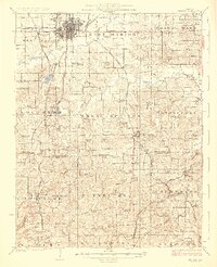
1925 Map of Marion
USGS Topo · Published 1925About this map
The growing city of Marion serves as the focal point for this mid-1920s survey of Williamson and Johnson Counties. This era shows a landscape transitioning through a dense network of country schools and rural churches, such as Mission Ridge School and McKinney Chapel, which anchored the small farming communities of West Marion and East Marion. The Southern Illinois topography is defined by the winding course of Craborchard Creek and the South Fork Saline River, while the southern reaches rise toward Wise Ridge.
Find a feature on this map
99 named features on this map. Tap any name to fly to it.
Don’t see what you’re looking for? This feature index may not catch every label — zoom into the map to look around manually.
Map Details
Editions of this 1925 Marion Map
3 editions found
Other maps of this area

1908 · Galatia
USGS Topo · 1:62,500

1909 · West Frankfort
USGS Topo · 1:62,500

1910 · Herrin
USGS Topo · 1:62,500

1917 · Brownfield
USGS Topo · 1:62,500

1918 · Vienna
USGS Topo · 1:62,500

1919 · Vienna
USGS Topo · 1:62,500

1920 · Dongola
USGS Topo · 1:62,500

1922 · Carbondale
USGS Topo · 1:62,500

1923 · Dongola
USGS Topo · 1:62,500

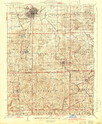
1925 · Marion
USGS Topo · 1:62,500