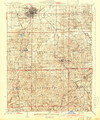
1925 Map of Marion
USGS Topo · Published 1942About this map
Marion serves as the primary urban hub in this Southern Illinois landscape, which was surveyed in the 1920s and revised just before the war. The map reveals a dense network of rural infrastructure, particularly the staggering number of country schools like Thorn Thicket School, Cherry Valley School, and Irish Ridge School. These small institutions, along with numerous houses of worship such as Mission Ridge School and the Mormon Church, reflect a highly decentralized agrarian society where community life was centered on the township level.
Find a feature on this map
104 named features on this map. Tap any name to fly to it.
Don’t see what you’re looking for? This feature index may not catch every label — zoom into the map to look around manually.
Map Details
Editions of this 1925 Marion Map
3 editions found
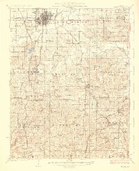
Other maps of this area

1908 · Galatia
USGS Topo · 1:62,500

1909 · West Frankfort
USGS Topo · 1:62,500

1910 · Herrin
USGS Topo · 1:62,500

1917 · Brownfield
USGS Topo · 1:62,500

1918 · Vienna
USGS Topo · 1:62,500

1919 · Vienna
USGS Topo · 1:62,500

1920 · Dongola
USGS Topo · 1:62,500

1922 · Carbondale
USGS Topo · 1:62,500

1923 · Dongola
USGS Topo · 1:62,500

1925 · Marion
USGS Topo · 1:62,500