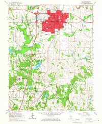
1966 Map of Marion
USGS Topo · Published 1967About this map
Marion serves as the bustling urban center of this mid-1960s survey, defined by its complex grid of schools like McKinley Sch and Longfellow Sch and its role as a regional hub for the Missouri Pacific Railroad and Illinois Central Railroad. To the west, the landscape transitions into the expansive Crab Orchard National Wildlife Refuge, where the Federal Penitentiary stands in proximity to Crab Orchard Lake. This period captures the town just as Interstate 57 began to reshape local transit patterns, bypassing older settlements like Hudgens and Neilson. The map is particularly detailed regarding community landmarks, including the VA Hospital and numerous rural houses of worship such as Freedom Ch and Shiloh Ch, alongside several family cemeteries that document the long-standing genealogical roots of Williamson County.
Find a feature on this map
45 named features on this map. Tap any name to fly to it.
Don’t see what you’re looking for? This feature index may not catch every label — zoom into the map to look around manually.
Map Details
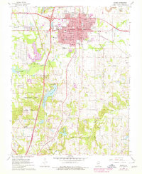
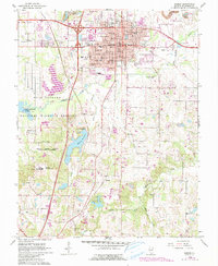
Editions of this 1966 Marion Map
3 editions found
Other maps of this area

1909 · West Frankfort
USGS Topo · 1:62,500

1910 · Herrin
USGS Topo · 1:62,500

1922 · Carbondale
USGS Topo · 1:62,500

1925 · Marion
USGS Topo · 1:62,500

1936 · Herrin
USGS Topo · 1:62,500

1940 · Marion
USGS Topo · 1:62,500

1941 · Carbondale
USGS Topo · 1:62,500

1941 · West Frankfort
USGS Topo · 1:62,500

1949 · Paducah
USGS Topo · 1:250,000

1950 · Paducah
USGS Topo · 1:250,000